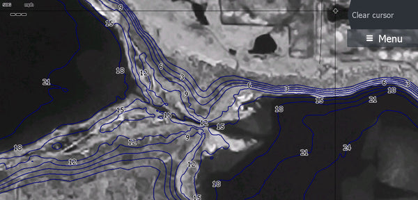

This is an update covering msny of the lakes in the SE with imagery of what areas looked like in low water era that I added lakes to until I ran out of space on the 32 gb chip . I didn't include the larger lakes I all ready have maps for. I did put in contour lines I use for Devils Lake but I didn't include any for Sakakawea. There are too many pot holes with out names to go over.
One of the things I wanted with this map was to make it so people could pick out lakes they've never been to before from across the the SE third of the state then to scan in. I've also included from G&F list of boat landings and fish cleaning stations so you can take care of cleaning without leaving them go too long. I've included state and national parks, forest areas, and non surveyed water bodies with as many names as I could. There's streets, Interstates, Major hiways, cities, and Refuges so you can check out what's around a lake and what towns are nearby. It's not perfect but close.
Here are some screen captures from a zoomed out level to close in to understand how it works.
Touch Screens only except the FS.


.
.