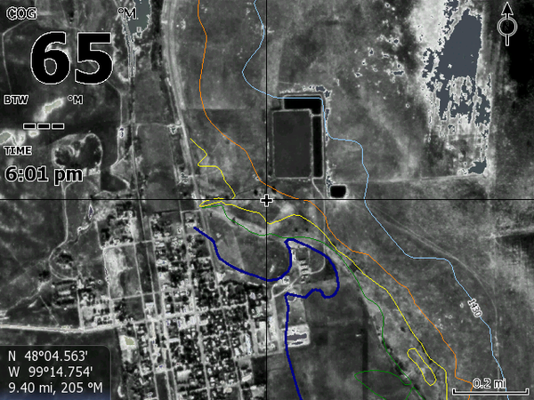
This map uses rectified infrared air photos that gives details as to the conditions of the land before the lake flooded large areas. The map is B/W IR from Devils Lake west and color IR to the east. It takes a bit of getting use to but people find areas of sand and rocks, pot holes and other man made construction. The map chip comes with the current lake level imagery for navigation in the lower resolution levels and our copy righted high resolution computer models with super high detail of the central main area of Pelican, all of Creel Bay and the Totten points and bay area.
Enhanced satellite image on an encrypted SD card for current Lowrance models.
HDS Pro, Live & Carbon
HDS Gen 1-2-3
Elite TI TI2
At this time the maps do not work in the Hook2 units. If and when in the future they will we will let everyone know.
Built-in Insight Maps will overlay the satellite image
.
.